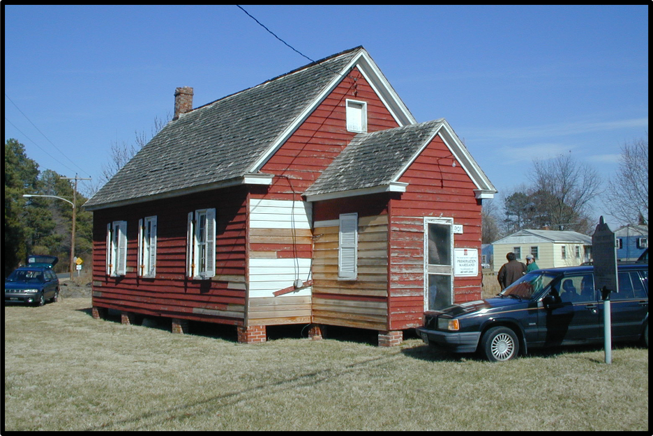
In 2003, AAHA reported on the Stanley Institute located just outside of Cambridge, Maryland. The Stanley Institute was a school that served the African American community of Christ Rock between 1867 and 1967. The property is listed on the National Register of Historic Places and the Maryland Inventory of Historic Properties.
The lot on which the Stanley Institute is located was owned by the Dali family of Baltimore in the early 1800s. In the mid-1800s, the Dali family began slowly subdividing their property, selling lots to African Americans for houses and small farms. It is unknown who owned the property when the school was opened, but in 1917, the Holland family of Dorchester County sold the property to the Trustees of the Rock School for $5 (Dorchester County Land Record WHM3:58).
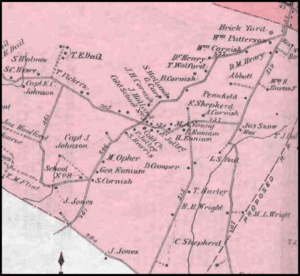
Ezekriel Stanley and Moses Opher led the effort to provide a school for the African American community of Christ Rock, assisted by the U.S. Bureau of War’s Freedmen’s Bureau and the Baltimore Association for the Moral and Intellectual Improvement for Colored People. The Institute was used as a school, community center, church, and meeting hall until 1875 when a church was constructed by the Methodist Episcopal congregation. The school and church both appear on the Hopkins 1877 Atlas of Dorchester County, Maryland.
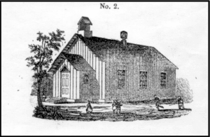
While the school was owned by the community, it was operated by the Dorchester County School Board from 1872 to 1967. From 1867 to 1944, the school was used for 1st through 7th grades and then transitioned to 1st through 6th grades after 1844. There were usually one or two teachers at the school and up to 85 students at a given time.
Community tradition states that the Stanley Institute building was moved to Christ Rock from the nearby Church Creek community. The building itself is an 18 ft wide by 22 ft long braced frame structure with an 8 ft rear addition and an enclosed front vestibule. The entire building rests on brick piers. The manner of construction is characteristic of the mid to late 19th century suggesting the structure had been reconstructed from older materials around the time of the school’s opening.
The 1910 annual school report describes a recent 8 ft addition on new brick piers, as well as interior improvements consisting of new plaster and wood wainscoting, and exterior improvements of new siding and a new chimney. With the new addition, the building appears to match the 1865 plans for acceptable public schools required by Reverend Libertus Van Bokkelen, the first superintendent of Public Instruction of Maryland. In addition to the school, a separate building on the property held the coal house and the privies. A well was dug sometime in the 1930s.
Results
AAHA’s initial Phase I survey consisted of 38 shovel test pits (STPs) at 25-foot intervals across the property and 5-foot intervals in the rear of the school where the outbuilding was reported to have stood. Additional STPs were excavated judgmentally around the school to define artifact density and related activity areas. The Phase I survey resulted in the recovery of artifacts throughout the property, with higher densities concentrated in three activity areas. A relatively higher presence of kitchen and personal items were noted outside of the front door. North of the school, the former basketball court was identified via compact soil and a lower density of artifacts. The probable location of the coal house and privies was identified with a higher concentration of artifacts, coal, and coal byproducts. Two possible features were also identified in this portion of the property.
The Phase II evaluation consisted of two 5×5 ft test units in the rear of the school and two 2.5×5 ft test units in front of the school, in addition to mechanical stripping of 50 square ft in the northern portion of the property to identify features.
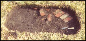
In front of the school, three features were identified, including a brick walkway. Three circular stains were also identified, likely related to the erection of signs on the property. Five large, shallow depressions were identified in the probable location of the coal house and privies. These features could possibly represent shallow post holes or privy pits, but that determination is not definitive. It is possible that the structure was placed on piers and trays were used for the disposal of wastes.
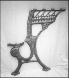
In total, 925 artifacts were recovered during the investigation. As expected, several artifacts aligning with expectations for a school house property were recovered, including a pencil sharpener, chalk, graphite, a pencil eraser holder, a pen casing. A large cast iron school desk fragment dated to 1883 was also recovered. Personal items recovered include buttons, straight pins, a comb fragment, and a pad lock. About 50% of the assemblage was made up of domestic artifacts including ironstone and porcelain sherds, glass tumbler fragments, canning jar fragments, and plastic flatware, suggesting the use of the property for social events. Most of the artifacts dated to the 20th century. The majority of the artifacts were recovered near the front entrance of the school, suggesting the deposition of material swept from the structure during cleaning episodes.