Our clients often use Phase IA assessments as a low-cost ‘first-look’ tool to help determining any cultural resources related critical issues during the due diligence or preliminary development stage. The assessment employs a combination of documentary research and advanced mapping techniques to establish the probability that an archaeological site or historic architectural resource might exist within your project area. The assessment is designed to avoid archaeologically sensitive areas or to inform the probable level of effort a targeted field investigation will take.
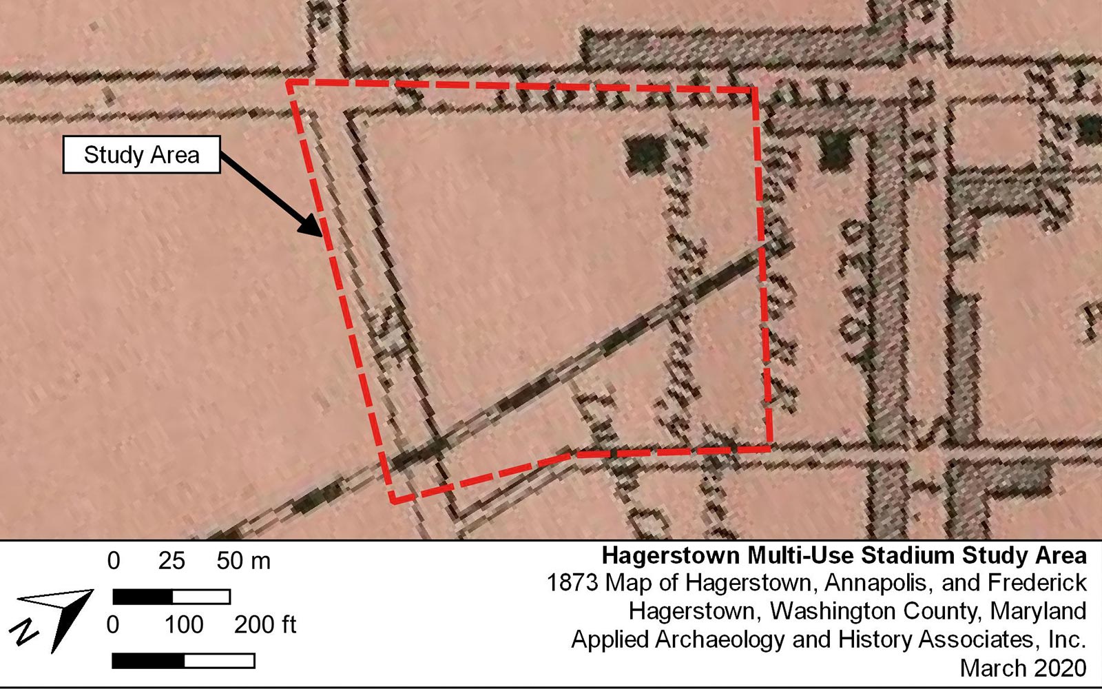
Historic documents, like tax assessments or probate records, can provide a snapshot of a property at a given point in time, while others, like census and land records, chart the development of a family or property over several centuries. Often, these documents will include references to buildings or landmarks that may be visible archaeologically. In addition, historic maps by private surveyors and the United States Geological Survey depict vanished landscapes across the Mid-Atlantic region. We consult all these sources and more during a Phase IA assessment to ensure you have the information you need to manage the development of your property.
To supplement the documentary research, we conduct an environmental analysis using Geographic Information Systems (GIS) technology. Many factors influence the placement of human settlements, from arable soils to freshwater access, and GIS allows us to collate all of these factors into one digital sensitivity map that can help you plan for your project.